The New 10-Year Lake Powell Plan and What It Means for Utah
The New 10-Year Lake Powell Plan and What It Means for Utah
When you live in the West, water is a big deal. And if you are thinking about moving to Utah and you do not think water is part of the conversation, you would be wrong. It is critically important here, and especially so in the seven states tied to the Colorado River Basin: Wyoming, Utah, Colorado, New Mexico, Arizona, Nevada and California.
The federal government just signed a new 10-year plan for how Lake Powell and Lake Mead get operated. Three days later, Nevada sued to throw it out. Here is what the plan actually says, what it does not say, and what it means for you if you own a home in Utah or you are thinking about moving here.
Where the Water Actually Sits
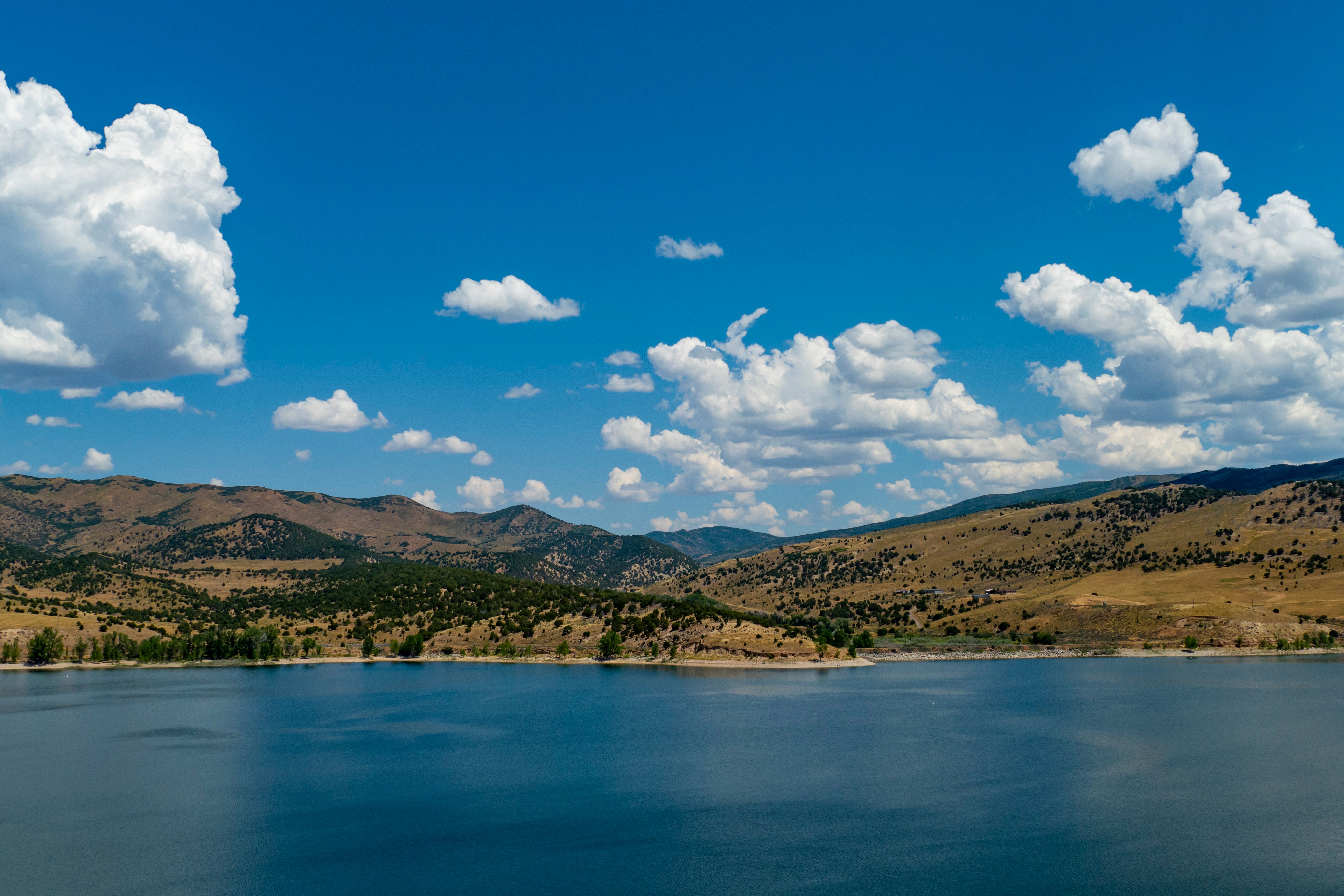
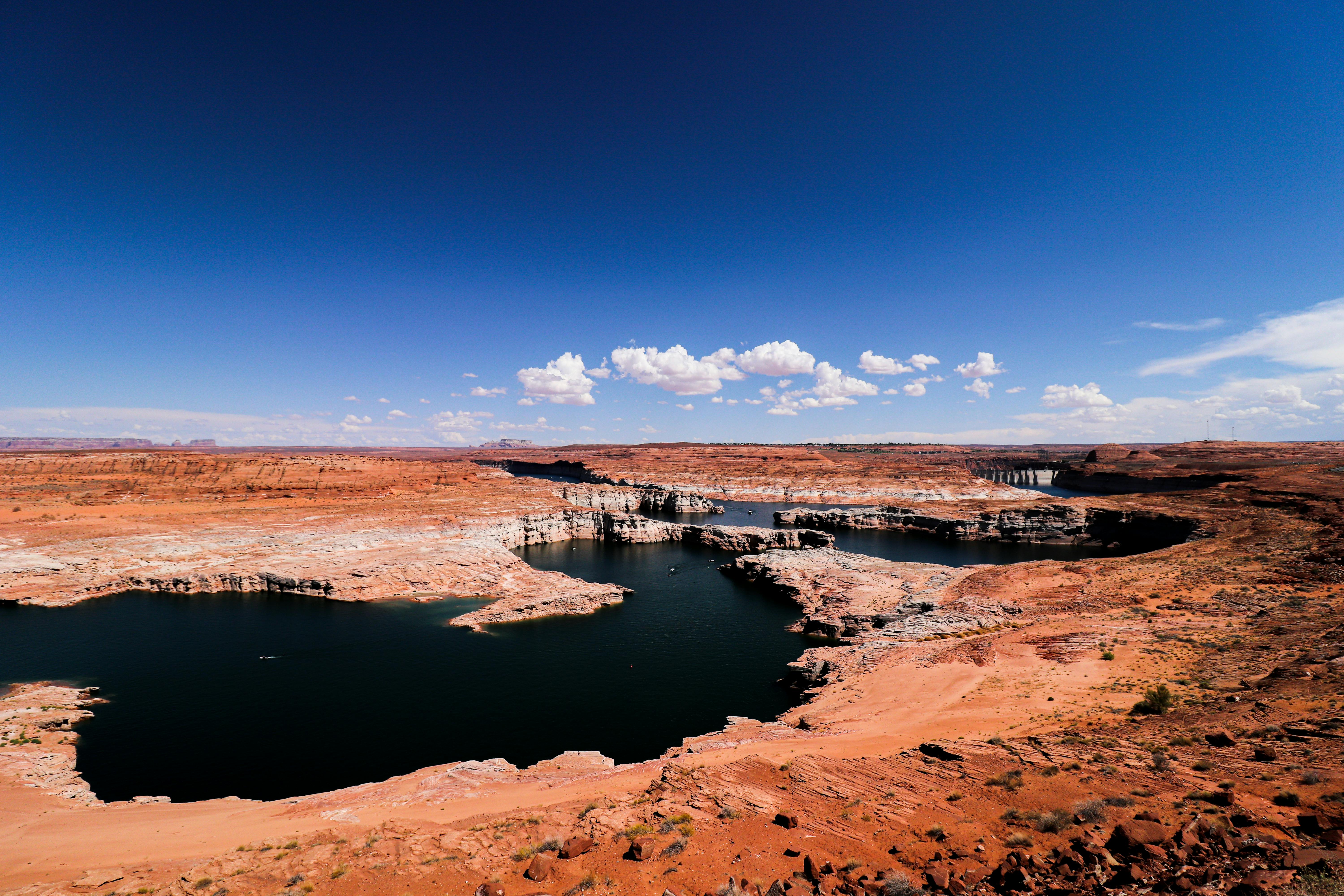
Full pool at Lake Powell is 3,700 feet. As of this week the reservoir was sitting at about 3,518 feet. That is roughly 182 feet down from full.
To give you a sense of how unusual that is: in 64 years of daily records, this August is lower than 98% of every August ever recorded. The typical August number is around 3,631 feet. We are more than 100 feet below normal for this time of year.
There are two more numbers below where we are standing. The first is minimum power pool at 3,490 feet. That is the elevation where Glen Canyon Dam can no longer spin its turbines and generate electricity, and we are about 28 feet above it. The second is dead pool at 3,370 feet, the elevation where water physically cannot pass through the dam. We are about 148 feet from that one.
So let me be clear about something. Anybody telling you Lake Powell is about to hit dead pool this year is selling you something. It is not getting there this year. But minimum power pool is genuinely close, and the lake dropped about 4.2 feet over the last 30 days, which is normal for the dog days of summer but still worth watching.
What the 10-Year Plan Actually Does
The official name is a mouthful: the decision framework for Colorado River guidelines and coordinated operations of Lake Powell and Lake Mead, running from 2027 through 2036. It was signed August 21st by Interior Secretary Doug Burgum, and it replaces both the 2007 guidelines and the 2019 drought contingency plans, which expire this year.
Here is the structural piece, and it is genuinely different from how the river has been managed for the last 20 years. They did not write a rule. They wrote what they are calling sideboards. Instead of a fixed formula that says at this elevation you release exactly this much, the plan sets a range: Lake Powell can release anywhere from 5 million to 12 million acre-feet a year, and the feds adjust inside that range every two years based on what is actually in the reservoir. For water year 2027 they are projecting somewhere between 6 and 7 million acre-feet.
For scale, an acre-foot is roughly what two Utah households use in a year.
Then there are the actual cuts for 2027 and 2028. Lower basin deliveries get reduced by 1.25 million acre-feet a year. Arizona takes 760,000 of that. California takes 400,000. Nevada takes 50,000. On top of that there is a requirement for at least 700,000 acre-feet of voluntary conservation across those two years. And the whole thing is built around protecting elevation 3,510 feet at Lake Powell.
Why 3,510 Feet? The Engineering Answer
This is the part almost nobody is talking about, and it is the piece that made the whole plan click for me. That number is not arbitrary and it is not an environmental or recreation target. It is physical.
Glen Canyon Dam has two ways to move water downstream. The main way is through the penstocks, the big intakes that feed the hydroelectric turbines. That is how the vast majority of water gets from Lake Powell through the Grand Canyon and into Lake Mead, generating power on the way. Those intakes stop working around 3,490 feet.
The backup is four smaller pipes near the bottom of the dam called the river outlet works. They were designed as a bypass. They were never designed to be the primary way this reservoir delivers water to millions of people downstream. In 2023 they ran a high-flow experiment through those bypass tubes, and when engineers inspected them afterward they found cavitation damage. Cavitation is what happens when water moves fast enough to form vapor bubbles that collapse against the metal, and over time it eats the pipe from the inside.
So the backup system, the one that is supposed to save you if the lake keeps dropping, has a known structural issue and limited capacity. That is why the line is drawn at 3,510 instead of 3,490 or lower. It is a buffer above the elevation where the dam has to start relying on damaged infrastructure to meet delivery obligations to Arizona, California, Nevada and New Mexico.
I spent years in construction before real estate, and this is exactly the kind of structural detail I find myself drawn to. The policy number exists because of a pipe.
Why Utah Is Not on the Cut List
Utah is not on the list of states taking a mandatory cut, and I want to explain why, because it is not because we won and they lost.
The seven states split into two halves. The upper basin is Utah, Colorado, Wyoming and New Mexico. The lower basin is Arizona, California and Nevada. The mandatory reductions in this plan land on the lower basin. Utah is simply not one of those states.
That sounds like good news, and in the near term it kind of is. But here is the honest version. The upper basin does not get a fixed allocation the way the lower basin does. What we get is whatever the river actually produces, minus our obligation to deliver water downstream. So our cuts do not come from a federal document. They come from the sky. In a bad snow year the upper basin already takes a massive cut automatically, whether anybody signs anything or not.
What Utah did agree to in this framework is voluntary, compensated conservation of up to 200,000 acre-feet a year across the whole upper basin, rather than a mandate from the federal level.
Gene Shawcroft, who chairs the Colorado River Authority of Utah, described this plan as a bridge, not a destination. I think that is the most accurate sentence anybody has said about this document. The seven states failed to reach a consensus deal and missed their February deadline, so the federal government wrote a framework that keeps the system operating while the states keep negotiating. The door is deliberately left open for a seven-state agreement to replace parts of it before 2027 operations begin.
For context on why any of this matters here: the Colorado River supplies roughly 27% of Utah's total water, about a third of the state's drinking water traces back to it, and around 60% of Utahns benefit from that river in some form.
And Then Nevada Sued
Three days after the plan was signed, on August 24th, the state of Nevada, the Colorado River Commission of Nevada and the Southern Nevada Water Authority filed suit in federal district court in Nevada.
Their argument is essentially three things: that the Department of the Interior violated the Administrative Procedure Act in how it made the decision, that it violated the National Environmental Policy Act in how it analyzed environmental effects, and that it misread what is called the law of the river, the stack of compacts, treaties and court decisions going back to 1922 that govern who gets what. They are asking the court to stop the plan and throw out both the framework and the environmental impact statement.
I am a real estate broker, not an attorney, so I am not going to predict how that plays out. But here is what I would point out. Nevada takes the smallest cut of any lower basin state, 50,000 acre-feet a year versus 760,000 for Arizona, and Nevada is the one suing first. That tells you the fight is not really about this two-year volume. It is about the precedent for the next 10 years and beyond. Legal analysts are already saying this is likely the first of many challenges.
So when I say this plan is a bridge and not a destination, understand that the bridge is being contested in court within days of being built.
What Is Physically Happening on the Lake
If you have been to Lake Powell in the last few years you already know this part. Bullfrog Marina, the big north end marina that a lot of Utah boaters use, had to physically move this spring. Not close. Move. They barged the marina, hundreds of houseboats and all, over to Halls Crossing, which is a two and a half hour drive around by road from where it used to be. The operator called it an engineering feat that had not been done at that scale before, and they finished in mid-June. If they had not done it, that marina would have been sitting on dry ground by July.
Meanwhile the Park Service is building a permanent answer. There is a $73.4 million boat ramp project at Stanton Creek designed to still function at elevation 3,500 feet, roughly 18 feet below where the water is right now.
Read that again. They are building infrastructure on the assumption that the lake goes lower than it is today. Forget the press releases and the lawsuits for a second and just watch where the capital goes. Nobody spends $73 million on a ramp for a water level they expect to recover.
Does Any of This Change Where You Should Buy?
This is the question I get in some form almost every week. Should I be worried about buying a home in Utah because of the water? My honest answer is both no and yes, and they are about two different things.
The no. If you are buying along the Wasatch Front in Salt Lake County, Utah County or Summit County, you are not drinking Lake Powell water. Our water up here comes primarily off the Wasatch and the Uintas, from snowpack and local reservoirs, plus the Central Utah Water Project. Lake Powell dropping another eight feet does not turn off your tap in Holiday or Draper or Saratoga Springs or Lehi. That is a real distinction, and most national coverage does not make it. They lump Utah in as one state.
The yes. Utah is projected to grow from about 3.6 million people to 5.6 million by around 2060. The state's own draft water plan says that without changes in how we use water, demand outruns supply by about 674,000 acre-feet a year by 2060. With aggressive conservation that gap drops to roughly 128,000. And water providers need somewhere around $1.2 billion a year just to maintain and upgrade the infrastructure we already have.
That money comes from somewhere. It shows up in impact fees on new construction, in secondary water metering, in landscaping ordinances, and in what your water bill looks like in 10 years. Water here is cheap right now, arguably cheaper than it should be, and we waste more of it than almost anywhere else in the country.
Three Things to Check Before You Write an Offer
This is the practical part, and it applies to any property in Utah.
First, is the property on culinary water, secondary water, or a private well? Second, which water district is it in, and what does that district's assessment look like? Third, if there is any acreage attached, do water shares convey with the property or not?
That last one has quietly cost people real money in this state, and it almost never shows up on the listing.
One more note: St. George is a completely different market on this. Washington County runs its own system, including Sand Hollow, with discussion of an additional reservoir and long-running talk of a pipeline from Lake Powell. That last idea draws real criticism from other basin states, given that Utah is not currently taking the mandatory cuts the lower basin is.
The Short Version
Lake Powell sits around 3,518 feet. The plan protects 3,510. That number exists because of damaged bypass pipes inside the dam, not because of a policy preference. Arizona, California and Nevada take the mandatory cuts while Utah, New Mexico, Wyoming and Colorado do not, but our exposure is voluntary and weather-driven instead. And the Park Service is building for a lower lake, which tells you what the people closest to it actually expect.
None of that means do not move to Utah. It means know what you are buying and ask the right three questions before you do.
Thinking About Moving to Utah? Let's Talk.
Utah is one of the fastest-growing states in the entire country, and navigating the cultural landscape alongside the real estate market takes genuine local expertise. Whether you're considering Salt Lake County, Utah County, Davis County, or further out — finding the right neighborhood for your lifestyle, budget, and long-term goals makes all the difference.
My team and I work exclusively with buyers and sellers navigating the Utah real estate market. We help you cut through the noise, match the right submarket to your specific lifestyle and priorities, and make sure you're buying from a position of clarity — not FOMO.
Book a call with us HERE — free 30-minute consultation
Check out our relocation guide HERE
Subscribe to our weekly newsletter HERE
The Steele Group is committed to the letter and spirit of the Fair Housing Act. We do not steer buyers toward or away from any area on the basis of race, color, religion, sex, disability, familial status, national origin, source of income, sexual orientation, or gender identity. Equal Housing Opportunity.
Categories
Recent Posts